Brevard County Flooding: Flash Flood Emergency Shuts Schools
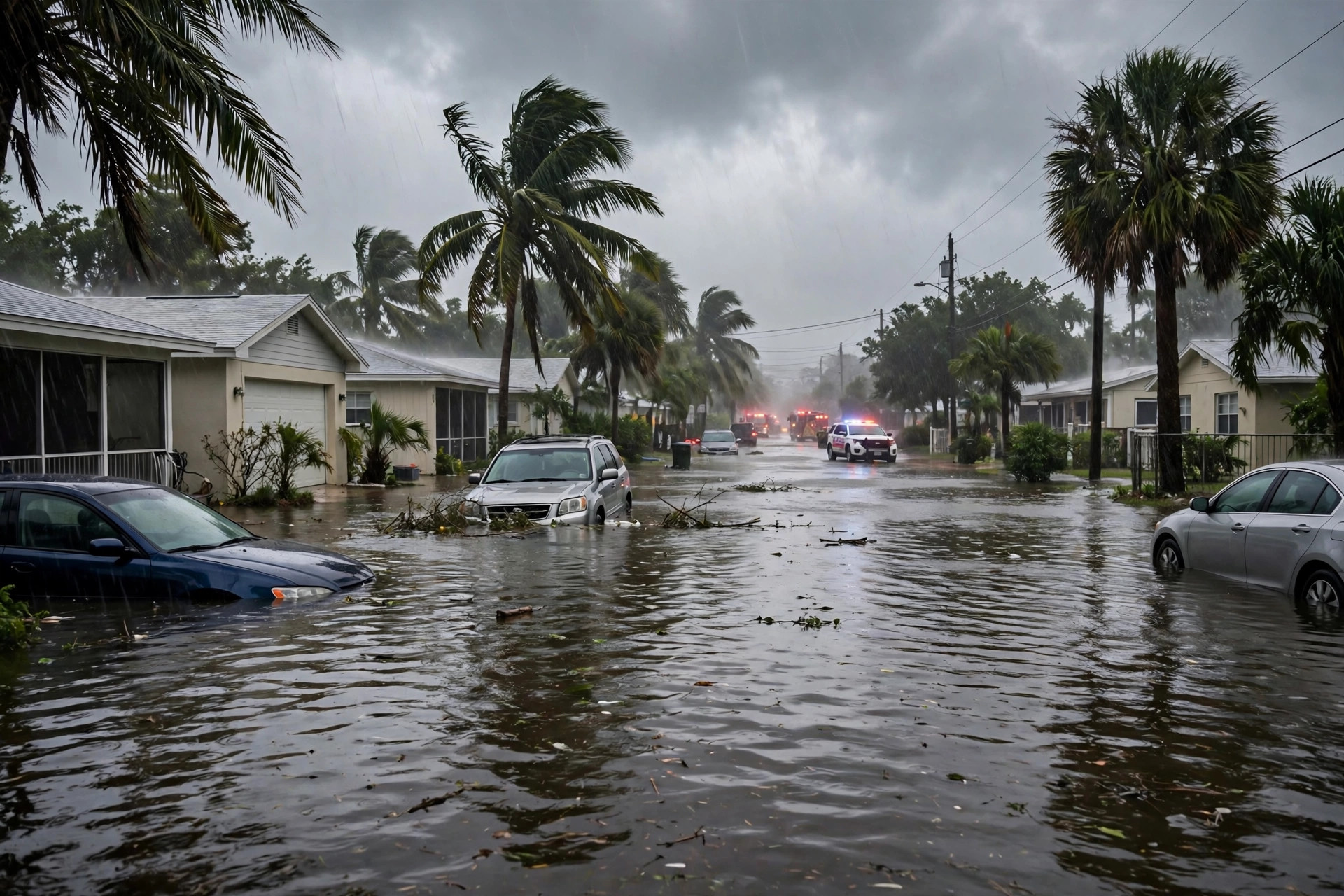
Brevard County, Florida, woke on Monday, November 2, 2026, to streets under water, cars stalled in rising floodwaters and schools closed for the day, as the National Weather Service warned residents of what it called an extremely dangerous and life-threatening flash-flood situation on the state’s Space Coast.
The warning followed a night of relentless rain that fell on ground already soaked by days of wet weather and swollen by last week’s king tides. In the hardest-hit southern part of the county, some gauges recorded 12 to 15 inches of rain, while other communities measured 4 to 7 inches, according to the National Weather Service office in Melbourne. A Flash Flood Emergency was in effect for Brevard County through late Monday morning, with forecasters reporting vehicles stalled in the Palm Bay area and warning that additional heavy rain was still to come.
“This is an extremely dangerous and life-threatening situation,” the Weather Service said in its statement. “Do not attempt to travel unless you are fleeing an area subject to flooding or under an evacuation order.” As of late Monday morning, no evacuation orders had been issued for the county, but officials were urging residents in the strongest terms to stay off the roads.
Schools closed and offices shut as water rises
Brevard Public Schools closed all schools on Monday for the safety of students, teachers and bus drivers, Sheriff Wayne Ivey said. Florida Tech and Eastern Florida State College also cancelled classes, and Burrell College in Melbourne closed its campus for the day. Kennedy Space Center advised staff to work from home because of roadway flooding.
Health First Medical Group closed its physician offices, laboratories and imaging centers on Monday morning, cancelling elective surgeries through 11 a.m. and delaying openings at its family pharmacies, although its hospitals remained open. Aerospace company L3Harris also closed its offices. In Cocoa Beach, the city closed recreational facilities and a golf course, reduced trash pickup and asked residents to conserve water because the wastewater system was strained by the volume of rain.
The closures underscored how quickly an ordinary Monday turned into a county-wide disruption. For many families, the decision was made for them: roads that looked passable in the dark became impassable by daylight, and school buses could not safely run routes where water covered the pavement.
Palm Bay and Grant-Valkaria take the brunt
Palm Bay and Grant-Valkaria took the brunt of Monday’s flooding, National Weather Service meteorologist Zach Law said, with some areas receiving 12 to 13 inches of rain and individual gauges measuring 14 to 15 inches. Titusville recorded 4 to 5 inches, while Viera saw 4 to 7 inches. In some Palm Bay neighborhoods, floodwater overtook cars parked in roadways, crept up driveways and saturated lawns, and rose halfway up stop signs in places where police blocked off portions of Heritage Parkway.
“We’re seeing streets underwater everywhere,” said Lt. Vincent Galioto, spokesperson for the Palm Bay Police Department. “If you see water, don’t drive through it. Some people were getting stuck overnight and our patrol cars can get down to them.” Galioto said the department had small boats and pickup trucks available to help with potential rescues.
Palm Bay Fire Rescue handled nearly a dozen calls for motorists stranded in rising water. The department’s own headquarters was hit by the deluge, with some flooding forcing firefighters to move operations to City Hall. Major residential roadways, including Jupiter Boulevard and Garvey Road, were heavily flooded in parts, and several of the city’s large canals were swollen and creeping up along their edges.
Catherine McDonald, who lives in the northwest section of Palm Bay, woke at 5 a.m. to find floodwater overtaking her front yard, with several cars parked outside nearly covered by the rising water. She said she had lived in the neighborhood for 13 years and had never seen anything like it, adding that emergency alert messages followed through the morning as conditions worsened.
Why the rain would not stop
Meteorologists attributed the deluge to a slow-moving front to the south combined with easterly winds carrying deep moisture from the Atlantic, producing training bands of showers and thunderstorms that repeatedly passed over the same areas. The National Weather Service in Melbourne reported 8 to 10 inches of rain had already fallen in southeastern Brevard County by early Monday morning, with 2 to 4 additional inches possible.
The timing made a bad situation worse. King tides the previous week had already swamped Space Coast beaches and mainland areas near the Indian River Lagoon and its canals, leaving lagoon, river and groundwater levels elevated. With drainage systems already full, heavy rain had nowhere to go, so water backed up in canals, stormwater systems and low-lying neighborhoods. High tide at around 2 p.m. Monday also temporarily reduced the ability of drainage systems to discharge runoff into waterways.
Forecasters said the pattern would continue through the afternoon, bringing at least 3 to 4 more inches to some parts of southern Brevard. Fox Weather reported that the most intense rainfall would begin to fade later in the afternoon, but that the flood threat would remain into Tuesday, with a further 2 to 3 inches likely through Monday and a Level 1 out of 4 flash-flood risk from the Space Coast to Miami on Tuesday.
A wider Florida flood threat
Brevard was the epicenter on Monday, but it was far from the only part of Florida under water. All of South Florida was under a flood watch through Monday evening, with the National Weather Service predicting 1 to 3 more inches of rain, and up to 9 inches possible in isolated areas, along with the potential for rapid flash flooding. Much of the state’s east coast was under a Level 2 out of 4 flash-flood threat, covering major cities including Miami, Jacksonville, West Palm Beach, Fort Lauderdale, Melbourne and Key Largo.
In South Florida, the combination of autumn high tides, a closer-than-usual full moon last week and an area of low pressure over the Bahamas interacting with high pressure over the Mid-Atlantic produced heavy rain, winds gusting to nearly 50 mph and waves up to 15 feet, according to the Palm Beach Post’s live coverage. Streets and highways in South and Central Florida became impassable in places, and Brevard County was not alone in closing schools: Okeechobee County closed schools and county offices on Monday and opened a shelter at Seminole Elementary School after communities around Lake Okeechobee were inundated with 5 to 7 inches of rain on Sunday.
Along the Atlantic coast, a coastal flood threat added to the danger, with rough surf and dangerous rip currents and onshore winds producing waves of 4 to 6 feet or higher. The National Weather Service in Melbourne maintained a flood watch through 7 p.m. Monday for east central Florida and a flash-flood advisory through the evening, repeatedly extending warnings as the rain continued.
What officials are asking residents to do
Officials’ message on Monday was consistent and blunt: stay home if you can, stay off flooded roads, and never drive through water when you cannot see the road beneath it. Sheriff Ivey warned that drivers might not be able to tell whether a roadway had been washed out, increasing the risk of accidents and injury. Police in several municipalities issued similar warnings, and Palm Bay police stressed that patrol cars and rescue vehicles could reach people who were stuck, but that prevention was far safer than rescue.
Residents were also urged to heed emergency alerts, avoid walking or driving through floodwater, and to move to higher ground if water began entering their homes. Forecasters cautioned that conditions could change quickly: a road that was passable in the morning could be under water by the afternoon as additional bands of rain moved through, and saturated ground meant even moderate additional rainfall could cause new flooding.
For Election Day on Tuesday, November 3, the weather picture remained unsettled. While the heaviest Florida rain was expected to ease, isolated flooding remained possible from the Space Coast to Miami, and a separate severe-storm threat was developing over the Plains and moving toward the Deep South. Voters in flood-affected areas were advised to check local conditions before travelling and to allow extra time if they needed to reach a polling place.
Frequently asked questions
What is a Flash Flood Emergency?
A Flash Flood Emergency is the National Weather Service’s highest level of flash-flood warning. It is issued when life-threatening flash flooding is occurring or expected imminently, and it signals that the situation poses an exceptional threat to life and property.
Which areas of Brevard County were hit hardest?
Palm Bay and Grant-Valkaria took the brunt of Monday’s flooding, with some gauges measuring 12 to 15 inches of rain. Flooding was also reported across large parts of the county, from Titusville and Viera to Melbourne, Satellite Beach and the roadway in front of Patrick Space Force Base.
Are Brevard County schools open on Tuesday?
Brevard Public Schools closed all schools on Monday, November 2, because of flooding. Families should check the district’s official announcements for Tuesday’s status, as conditions were still being assessed on Monday afternoon.
Is it safe to drive through floodwater?
No. Officials warn never to drive through flooded roads, especially when the road surface cannot be seen. As little as a foot of moving water can sweep a vehicle away, and flooded roads may be washed out underneath. The rule is simple: turn around, don’t drown.
How much more rain is expected in Florida?
Forecasters expected a further 2 to 3 inches through Monday across much of Florida’s east coast, with 1 to 3 more inches possible in South Florida and up to 9 inches in isolated areas. A lower-level flash-flood risk remained in place for Tuesday from the Space Coast to Miami.
Sources: National Weather Service Melbourne; Florida Today; Fox Weather; Palm Beach Post; Florida Public Radio Emergency Network.
Related coverage: Sedona Evacuations as Oak Creek Floods Arizona | Pagosa Springs Braces as San Juan River Forecast Tops 1911 Record | Southwest Flooding: New Atmospheric River Threatens Arizona and New Mexico