Pagosa Springs Braces as San Juan River Forecast Tops 1911 Record
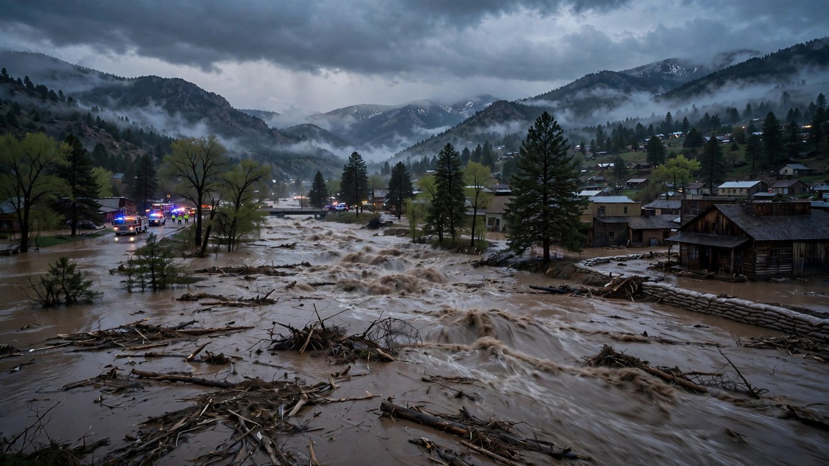
Pagosa Springs, Colorado, spent Sunday night facing a flood forecast that would rewrite the town’s history. The San Juan River was forecast to crest at about 21.8 feet late Sunday, well above the 17.8-foot mark set in the devastating 1911 flood that wiped out most of what then existed as the town, according to the Archuleta County Sheriff’s Office and National Weather Service forecasts reported Sunday.
Officials warned of a “potentially catastrophic flood event” and said extensive damage was expected. Mandatory evacuations covered low-lying areas along the San Juan, Rio Blanco, Navajo and Piedra rivers, including downtown Pagosa Springs, and the town was closed to incoming traffic from Sunday afternoon. More than 1,000 homes were under mandatory evacuation orders, Sheriff Mike Le Roux said, and officials said they could not say how many people remained in the evacuation zones.
The same Pacific storm system that soaked the Southwest through the weekend also forced evacuations across Arizona, and forecasters warned that the danger was now shifting east. Severe storms were expected across parts of Kansas, Oklahoma and north Texas on Monday afternoon and evening, with the threat moving into the Deep South on Election Day, Tuesday, November 3.
A forecast that kept rising through Sunday
The forecast crest for the San Juan River at Pagosa Springs rose repeatedly during Sunday, from about 19 feet to about 21.87 feet, according to reports citing the National Weather Service. By sundown Sunday, the river had reached about 14 feet, county spokesperson Vicky Schaffer said, and by 8 p.m. local time it stood at about 16.81 feet — above last week’s peak of about 15 feet — before easing to about 16.2 feet by 9 p.m. It remained above major flood stage, and the forecast crest of about 21.8 feet by about 11 p.m. local time had not been called off.
The 1911 comparison is what alarmed officials most. In that flood, the San Juan crested at approximately 17.8 feet and destroyed most of the town as it then stood. A crest near 22 feet would be about four feet above that record and roughly seven feet above the flooding seen last week, forecasters said.
Rain, rather than snow, was driving the surge: a National Weather Service meteorologist said rain was falling up to 11,000 feet and running straight into the rivers, with 8 to 12 inches recorded since Friday in parts of the San Juan Mountains.
Evacuations, closed roads and a shelter open
Archuleta County ordered people in low-lying and flood-prone areas to leave, including areas along Stollsteimer Creek next to US 160, and asked everyone else to shelter in place and avoid non-essential travel because of dangerous road conditions. An emergency shelter opened at the Pagosa Lakes clubhouse, at 230 Port Avenue. Roads in and out of the town were closed, and residents not under evacuation orders were urged to stay home.
State and local agencies pre-positioned search-and-rescue teams and called in Colorado National Guard units, warning that emergency response could be limited during peak flooding. La Plata County closed all county roads, and San Juan County ordered anyone within half a mile of the La Plata, San Juan or Animas rivers to leave on Sunday night.
The town also warned that sewage was being discharged into the San Juan near the 1st Street bridge and told people to avoid all contact with river water. The Conejos River in southwest Colorado was likewise forecast to crest above its 1911 record.
Arizona: Sedona, Camp Verde and Gisela ordered out
In Arizona, Sedona officials ordered residents near Oak Creek to leave immediately as floodwaters trapped multiple people in their homes. Camp Verde issued orders for residents near the Verde River, West Clear Creek and Wet Beaver Creek, and Gila County ordered the total evacuation of Gisela, a community of several hundred people along Tonto Creek.
Flagstaff saw nearly nonstop rain that flooded roads and overwhelmed storm drains, while Tucson saw swift-boat rescues. Aaron Hardin, a National Weather Service meteorologist in Tucson, said Arizona was getting “two or three months of rain in a span of a couple of days.” Flood watches covered nearly all of Arizona and parts of Utah, Colorado, New Mexico and Nevada.
As of 2:37 a.m. Eastern on Monday, Flagstaff’s Weather Service office had extended a flash flood warning for Coconino County, and a flood warning along the Verde River remained in effect until 10 p.m. Eastern on Monday.
Storm threat moves to the Plains on Monday, the Deep South on Election Day
Forecasters said the severe-weather risk would shift east on Monday. A cold front and dryline were expected to trigger severe storms on Monday afternoon and evening over Kansas, Oklahoma and north Texas, with large hail, damaging winds and a few tornadoes possible. The Storm Prediction Center placed a Level 2 of 5 risk over south-central and eastern Kansas, western and central Oklahoma and north Texas.
On Election Day, Tuesday, November 3, the front was expected to reach the Deep South, with damaging winds possible in Louisiana, Mississippi, Arkansas and Alabama, and AccuWeather said Missouri and Tennessee could also be at risk. Heavy rain of 1 to 2 inches or more was expected from Texas to Minnesota on Wednesday.
Officials urged voters and travellers to check local forecasts, road closures and polling-place information before heading out, and warned against driving through flooded roads.
Why this flood is different
This is the second historic flood event in about ten days for the Four Corners region, and forecasters said saturated soils and river channels altered by earlier flooding would complicate recovery. For Pagosa Springs, a town of more than 2,000 people known for its hot springs and nearby ski resorts, the full extent of damage will not be clear until waters recede and crews can safely reach affected areas.
Frequently asked questions
How high is the San Juan River forecast to crest at Pagosa Springs?
About 21.8 feet late Sunday local time, according to the latest National Weather Service forecast reported Sunday night — about four feet above the 1911 record of 17.8 feet.
Which areas are under mandatory evacuation?
Low-lying and flood-prone areas along the San Juan, Rio Blanco, Navajo and Piedra rivers, including downtown Pagosa Springs and areas along Stollsteimer Creek, plus, in San Juan County, anyone within half a mile of the La Plata, San Juan or Animas rivers.
Where is the emergency shelter in Pagosa Springs?
At the Pagosa Lakes clubhouse, 230 Port Avenue, according to the Colorado incident management team.
Is it safe to travel to Pagosa Springs?
No — the town was closed to incoming traffic on Sunday afternoon, roads in and out were closed, and officials asked people to stay home and avoid non-essential travel. People can leave but will not be let back until authorities say it is safe.
Will storms affect Election Day?
Potentially: severe storms with damaging winds are forecast for the Deep South on Tuesday, November 3. Check local forecasts and polling-place updates before travelling.
Sources: Associated Press via Arab Times; Republic World; Primetimer; Balanced Weather; Nacionale; TravelTourister. Links below.
Related coverage on NationWire: Sedona Evacuations as Oak Creek Floods Arizona and Southwest Flooding: New Atmospheric River Threatens Arizona and New Mexico.